Description
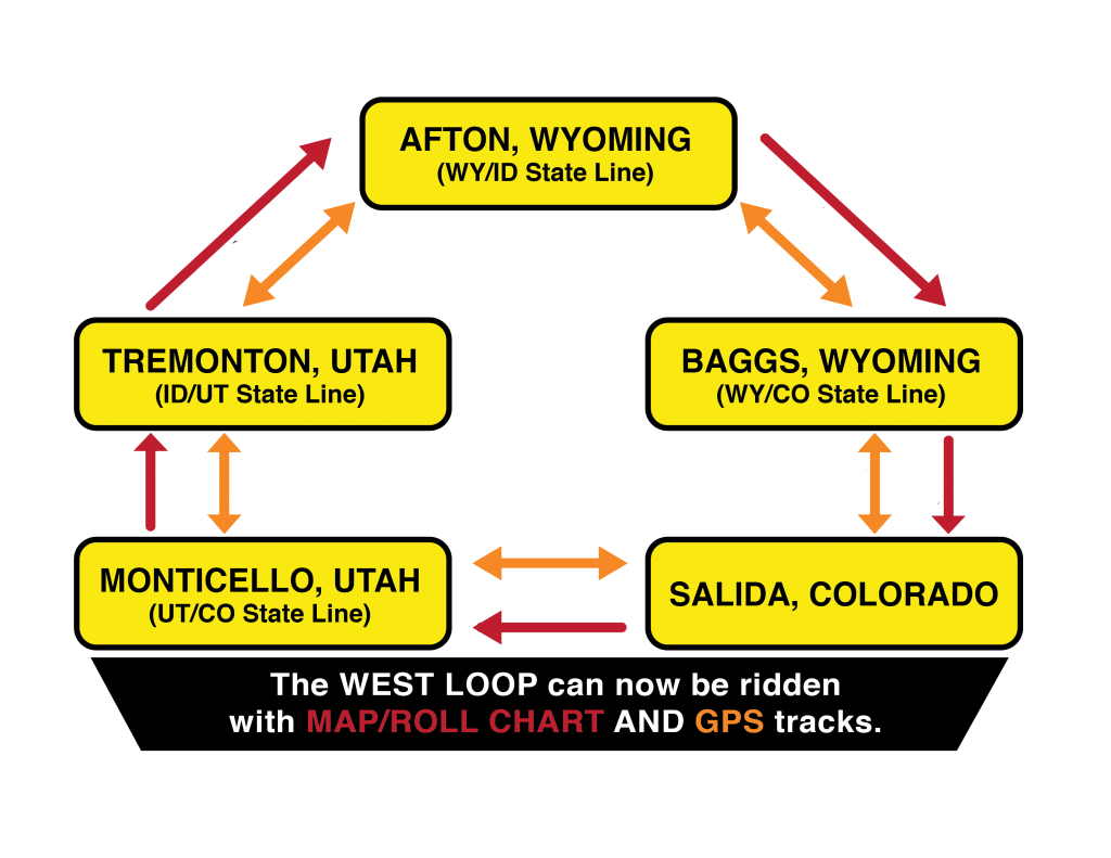
For GPS tracks only because of multi-directional travel
Total miles= 2,800
Allow 12 to 14 days to complete
The WEST LOOP can now be ridden with map/roll chart AND GPS tracks.
MAPS NEEDED:
- Colorado TAT
- Colorado WEST LOOP
- Utah TAT
- Idaho TAT
- Wyoming TAT
Note: Check to be sure that you do not order duplicate maps.
IMPORTANT: The route for the Colorado WEST LOOP is the same as the Colorado Shadow of the Rockies, EXCEPT the Colorado WEST LOOP is clock-wise, North to South, and the Colorado Shadow of the Rockies is counter clock-wise South to North. Please understand the difference.
GPS TRACKS NEEDED:
- Colorado TAT
- Colorado WEST LOOP
- Utah TAT
- Idaho TAT
- Wyoming TAT
If you convert the TRACKS to ROUTES, be sure that the converted route is in the direction that you want to travel.
Receiving and Delivery Times for Maps & Rolls Charts
Receiving and Delivery Times for GPS Tracks





Reviews
There are no reviews yet.